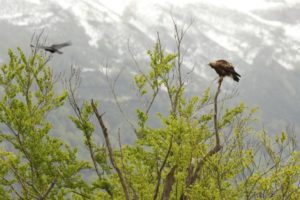
Status of the population of Golden Eagle Aquila chrysaetos in the province of Verbano Cusio Ossola
Bionda R.
Abstract:
The province of Verbano Cusio Ossola (VCO) lies in the northern part of the Piedmont region. It covers a surface of 2223 km2 and its altitudes ranges from 193 to 4599 m a.s.l.; 64% of which lies over 1000 m a.s.l. The climate is shaped by abundant rainfalls (1200-2500 mm/year) and typical continental winter temperatures, which tend to be milder in the Eastern part of the province thanks to the mitigating presence of Lake Maggiore. Woodland cov ers a major part of the VCO province (38%), consisting mainly of deciduous trees. Colonizing woods and shrubs (14%), alpine pastures (11%), moors and shrubs (9%), rocks, scree and river beds (8%), pastures and cultivated lands (7%) and sparsely vegetated lands (6%) follow in decreasing order of surface extent. Water covers approxi mately 4% of VCO surface, whereas urban and suburban areas stretch over 3%. Less than 1% is covered by per manent snowfields and glaciers (CORINE Land Cover; C.E.C, 1993). Available data for the Golden Eagle in the VCO province are not recent and substantially date back to surveys carried out more than a decade ago (Bionda 2003, Bionda & Bordignon 2006). Since then, the present author did not continue to monitor intensively the Golden Eagles. This study covers the period from 1996 to 2005 and cen suses were primarily carried out in March and April, when reproductive activities are taking place (Fasce 1982). After mapping the potential territories, pairs’ core areas were de fined by means of observations made from vantage points, usually in valley bottoms. Recording sessions were con centrated in the first part of the day. One aim was to record the starting point of pairs’ daily activities, marking and territory-defence flights (undulating flight, circling pairs), along with matings, transport of twigs and green matter to add to nests or exchanges of adults at nest during the brooding period. Suitable cliff faces for nest building were checked by means of binoculars and telescope. Surfaces of single pairs’ territories were estimated by defining their boundaries on the basis of searching, marking and terri tory-defence flights. The distance between territories was then used as index of population density, and this was cal culated by means of the nearest neighbour distance method (Newton 1979). Territories for each pair were based on the distance away from the only known nest or alternatively on the centroid of the polygon drawn connecting all nests be longing to that pair. The above surveys recorded the pres ence of 23 territorial pairs, 5 of which defended territories that partially overlapped the Italian-Swiss border: 4 terri tories stretched over the eastern boundary (Tessin Canton) and 1 over the western boundary of the province (Valais Canton). The mean distance between two adjacent territo ries was 7.15 km (min 4.7; max 13.8; SD 1.96). A total of 49 nests were recorded, ranging from 1 to 6 per pair (mean 2.3; SD 1.4). When comparing the status of the Golden Ea gle population with that of ten years ago, at least one new territory has been recorded since then, along with 8 further nests, one used by a new pair and seven used by known pairs. In the last ten years, two attempts of gaining new ter ritories along the eastern (near Lake Maggiore) and south ern (Mount Mottarone) boundaries of the province were recorded. In both attempts, territorial activities were regu larly observed, but no nests were found. Both territories were defended for one single season.
